Hiking
Millanas Route (Río Grande)
Among pools and old power stations: a riverside stroll along the Río Grande

Málaga
An easy walk of just 1.2 kilometres takes you to one of the best-known natural pools in the Sierra de las Nieves and ... two sites linked to the historical use of water.
-
Route details
Region: : Sierra de las Nieves
Municipality: Tolox
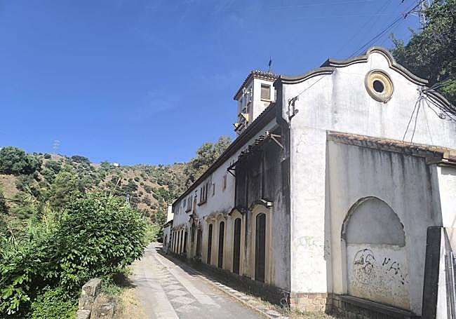
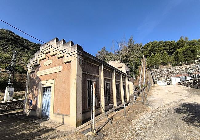
Location: : A linear trail running through the Las Millanas area alongside the Río Grande, between the former Central de San Eugenio (power station) and the Central Hidroeléctrica de San Augusto.
Difficulty level: Low. The main route follows a wide, virtually flat path. The only difficulty may be encountered at the access points to some pools and areas near the riverbed, where extreme caution is required due to the presence of rocks and slippery surfaces.
Route type: : Linear.
Approximate duration: 35 minutes (one way).
Length of the route: : 1.2 kilometres (one way).
Minimum altitude: 200 metres.
Maximum height: 226 metres.
Places of interest along the route or nearby: Charco del Pontón Alto, the Grande River, the former San Eugenio Power Station, San Augusto Hydroelectric Power Station, Zarzalones springs, the former San Pascual Power Station, Tolox spa, the town centre of Tolox, the town centre of Alozaina, the María Sagredo tower and the Church of Santa Ana.
Related story
-
How to get to the starting point
Access is via the A-366 road linking Tolox and Alozaina. At the 46-kilometre mark, a lane branches off and leads down into the Río Grande valley. There are several lay-bys where you can park, although at weekends in summer it is often difficult to find a parking space due to the large number of visitors. It is also important to respect any parking restrictions in place.
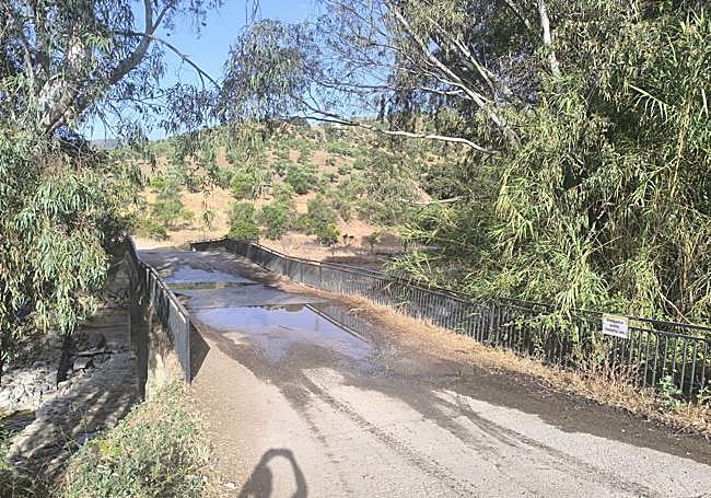
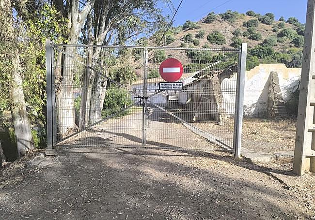
The start of the route is next to the bridge near the old San Eugenio power station. At this point, there is a gate with a ‘private property’ sign restricting vehicle access, but pedestrians are permitted to pass.
-
Route description
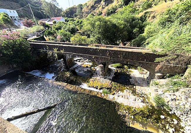
1. The route begins next to the old San Eugenio Power Station, one of the historic facilities linked to hydroelectric power generation on the River Grande. Before continuing, there is a gate with a ‘private property’ sign, which often causes confusion amongst visitors. According to information provided by the Tolox Tourist Office, the restriction applies only to vehicle access, so walkers can continue on foot along the track without any problems. From the very first few metres, after passing the old power station on the right, it is already clear that water will play a central role throughout the walk.
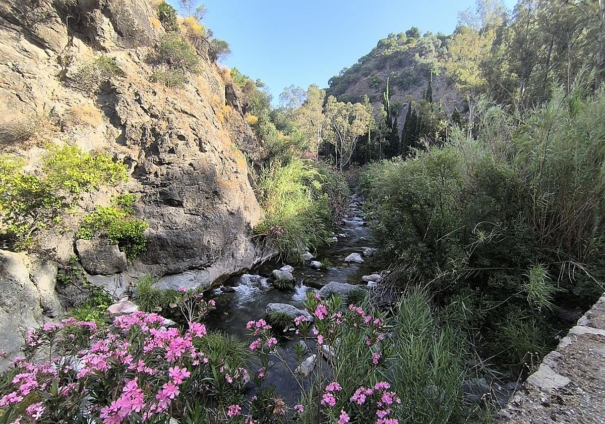
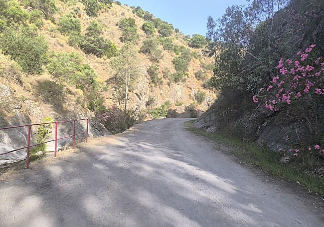
2. The path runs comfortably and is practically flat alongside the River Grande, which remains on the walker’s left at all times. The riverside vegetation provides shade in many sections and helps to create a particularly pleasant atmosphere during the hottest months of the year. The constant murmur of the water accompanies the walk as the valley is gently flanked by slopes covered in Mediterranean vegetation.
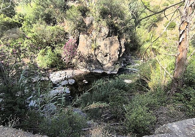
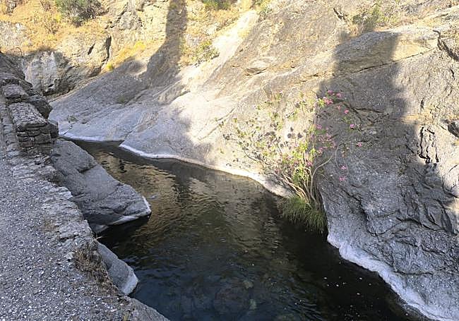
3. After walking several hundred metres, you’ll come to a small bridge situated just before the route’s main natural attraction. Nearby is the Charco del Pontón Alto, considered the most iconic pool in this part of Las Millanas. Its clear waters and the rocky surroundings make it one of the most photographed spots on the Río Grande. Anyone wishing to approach the riverbank should do so with caution, especially if the rocks you need to climb over are wet.
4. After leaving Pontón Alto behind, the track continues to climb slightly, passing alongside a number of private properties. The vegetation becomes increasingly lush. This section offers an insight into the close historical relationship between the Río Grande and the water-based developments that took place in the area. The area is known as Las Millanas, a name that still survives in the local area and continues to identify this section of the Río Grande riverbed. It is worth noting that for many years it served as a natural swimming pool for many local residents.
5.The route ends in the vicinity of the San Augusto Hydroelectric Power Station, another of the route’s most notable heritage sites. Reaching this point gives an insight into the importance of the River Grande as a source of energy for these facilities. Although the proposed route ends here, it is possible to continue upstream towards Zarzalones and the old San Pascual Power Station. From this point onwards, the route takes on a much more river-centred character, alternating between riverside paths and sections along the riverbed itself, so you’ll need to be prepared to get wet and wear suitable kit.
Flora and fauna
The Río Grande is home to one of the best-preserved riverside ecosystems in the Sierra de las Nieves area. Along the route, species such as oleanders, poplars, black poplars, willows and reed beds can be found; these thrive here thanks to the constant presence of water.
This vegetation not only provides shade and coolness along the path, but also serves as a refuge for numerous animal species. Among the most characteristic fauna are various birds associated with aquatic environments, such as kingfishers, wagtails and herons, as well as amphibians, reptiles and small mammals found along the riverbed. The river’s environmental quality makes this area one of the valley’s most valuable natural spaces.