Hiking in Malaga
Climbing the Mijas Peak: the path that leads to the iconic 'Bola' summit
The challenging Ruta Naranja begins at Puerto Colorado, taking you to to the top of the mountain range and rewards with spectacular panoramic views

Málaga
Ascend to Pico Mijas, also known as Pico de la Bola, from Puerto Colorado, within the Sierra de Mijas trail network. The route runs through the municipality of Mijas, although the summit is in Alhaurín el Grande - it forms part of the signposted orange route.
-
Route information
County: Costa del Sol Occidental / Valle del Guadalhorce
Municipality: Mijas y Alhaurín el Grande
Difficulty level: Medium-high. It is not difficult to navigate, but the steep almost 700 metre slope and the sustained climb require a good level of fitness. The surface is stony in many sections, especially in the final part.
Type of route: Linear
Approximate duration: : 2 hours - 2 hours and 15 minutes (one way)
Length: 5.54 kilometres (one way).
Minimum height: 469 metres
Maximum height: 1,150 metres
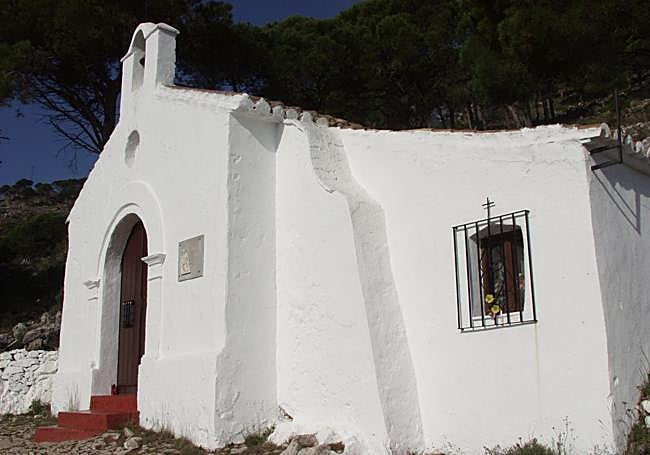
Nearby places of interest: Pico Mijas or la Bola, hermitage of El Calvario, viewpoints of Mijas Pueblo, Cantera del Barrio, Cruz de la Misión, Banco de la Memoria, hermitage of La Peña, church of La Inmaculada, botanical garden of La Muralla, bullring and hermitage of La Peña, among others.
-
How to reach the starting point
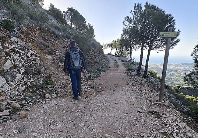
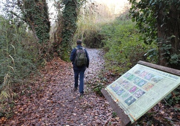
The starting point is at the Puerto Colorado, which is accessed from the road linking Mijas Pueblo with Coín. Just in front of this point there is a small esplanade where about ten vehicles can park, which is usually used by hikers.
-
Route description
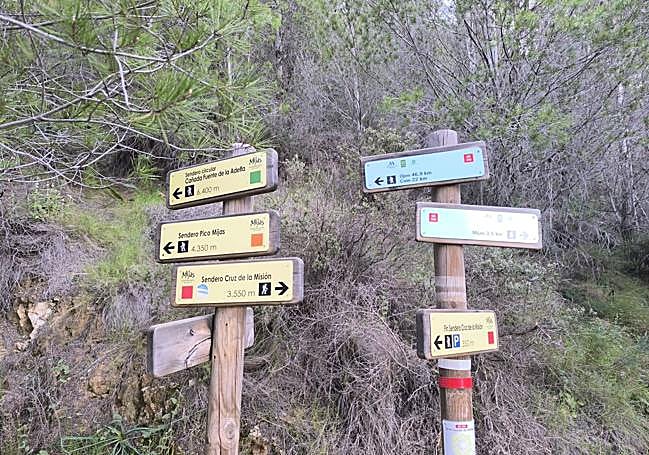
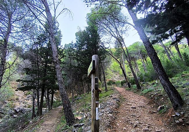
1After leaving the vehicle parked on the Puerto Colorado esplanade, cross the road to take the path that begins in front of it. After a few metres there is a gentle climb that leads, in just 300 metres, to the first signposted crossroads. Several directions coincide at this point, including the one that leads to Adelfas fountain, as well as the signposted green and orange routes. Continue along this common route for a few more metres until you reach a clear fork where the two paths separate. At this point you should take the turning to the left, corresponding to the orange route, this is the one that leads to Poco Mijas.
2After passing the previous fork, the path continues with a gentle climb in a westerly direction, bordering the slope of the sierra. This section is easier, but the route slowly changes direction with a turn to the right, heading east, where the slope becomes more apparent. You will then reach a forest track, at which point it briefly coincides with a section of the Gran Senda de Malaga, before leaving the track to continue along a steeper path.
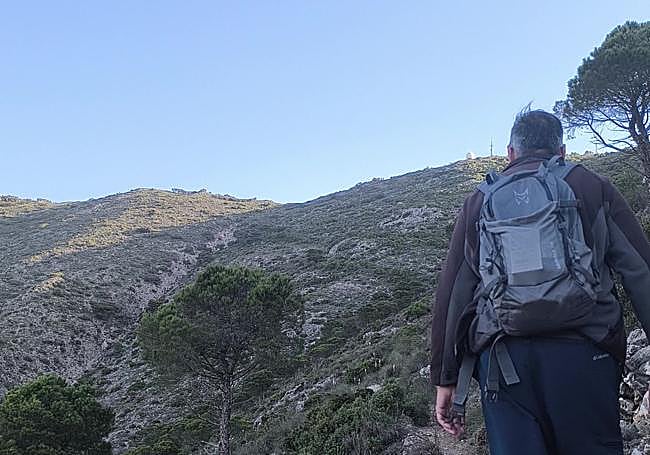
3From this point onwards, the path becomes a more challenging climb heading north, running parallel to the Pedregal ravine, which is on the left for a good portion of the journey . The route steadily gains altitude over increasingly rocky terrain, in a sustained stretch that demands more effort than other parts of the route. After reaching approximately four kilometres from the start, the route changes direction towards the south and begins to trace several zigzags that allow us to overcome the final slope in the last few metres of the route.
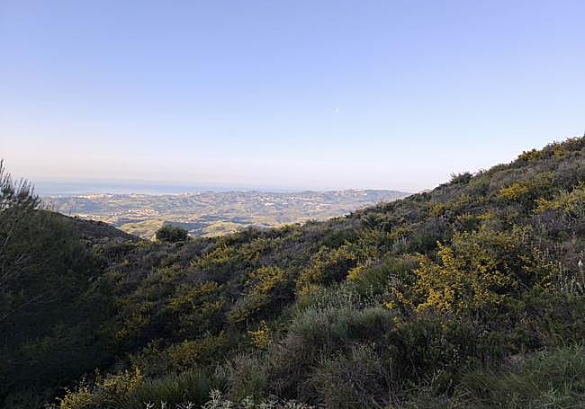
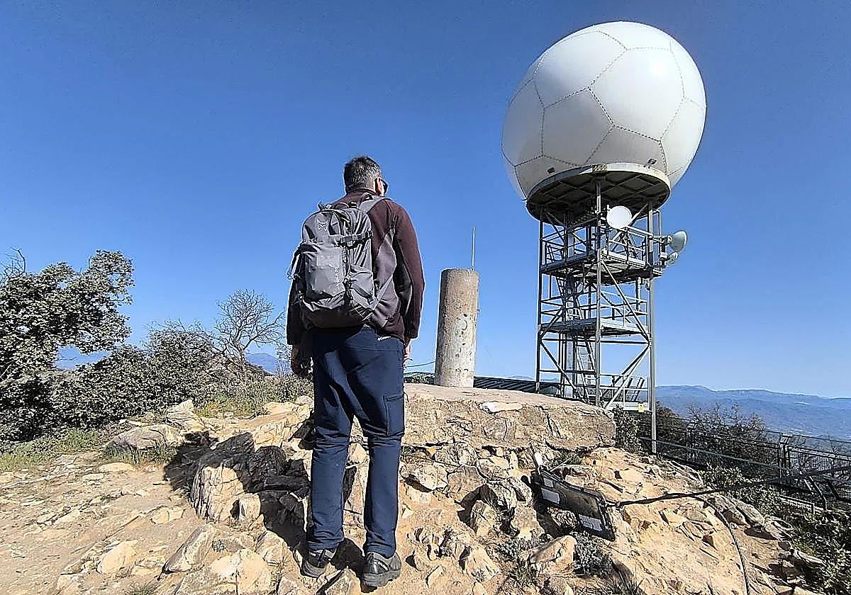
4As you gain altitude, the vegetation clears and the landscape opens up, giving way to sweeping panoramic views. Look towards the south and see much of the Costa del Sol unfolding from Fuengirola and, on some days, even make out the African coast. Interestingly, Mijas Pueblo is not visible from this route. Against this backdrop, the path continues to climb until the objective of the route comes into clear view: Pico Mijas, easily recognisable by the AEMET weather installations that crown the peak, the well-known 'bola'.
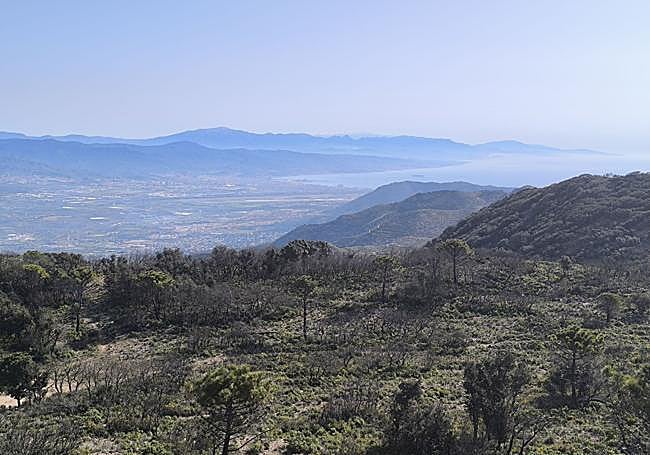
5However, the installations aren’t accessible, the path skirts them slightly until you reach the geodesic vertex ( a surveying point) that marks the summit of Pico Mijas, at an altitude of 1,150 metres, considered to be the highest point in this mountain range. From this point you can enjoy truly spectacular 360-degree panoramic views. The landmarks of the north and east become clear, with the Guadalhorce Valley, Malaga city and its bay, the Sierra de las Nieves, the Torcal de Antequera and, on clear days, even the Sierra Nevada. You can also clearly distinguish towns such as Alhaurín el Grande and Casarabonela, making up one of the most complete panoramic views of the Western Costa del Sol. For the return journey, the best option is to follow the same path back to Puerto Colorado, although those who are familiarised with the area can choose to extend the route by connecting with other routes within the network of paths in the Sierra de Mijas, with signposted links to enclaves such as Cerro Málaga or via routes that lead to the area of the Mijas Quarry, among other alternatives.
Flora and fauna
Despite the fires suffered in recent decades, the Sierra de Mijas maintains an ecosystem of great value, with voices that continue to call for greater environmental protection for this space.
Related story
-
 Javier Almellones
In terms of plants, various species of pine forest predominate, accompanied by holm oaks and other associated formations such as kermes oak and cork oak. Also present are, wild olive trees, juniper, gorse and aromatic plants such as lavender and marjoram. Among these, the palmito stands out in particular, one of the most characteristic species of the Mediterranean scrubland in this area and closely linked to local tradition. As for the fauna, it is not uncommon to find traces of, or even spot, mammals such as the mountain goat, the wild boar or the fox. In the sky, birds of prey such as the booted eagle, the sparrowhawk or the kestrel are frequently seen, whilst among the reptiles, it's important to be aware of the presence of the common viper, a venomous species found in this environment.