Walking routes in Andalucía
The route that takes you on a journey of discovery through one of the most astonishing geological formations in the Axarquía
A popular, though unofficial, footpath from Nerja takes you past an old quarry and through a ravine with impressive rock faces and natural shelters

Malaga
This popular route, which is not officially recognised as a footpath, runs between the Maro-Cerro Gordo Cliffs nature reserve and the Sierras de Tejeda, ... Almijara and Alhama Natural Park, within the municipality of Nerja. Most of the route follows the Colmenarejos stream or runs along its bed - which is usually dry - through a small valley situated between Cerro de la Bandera to the west and Cerro de la Puerta to the east.
-
Route details
Region: Axarquía
Municipality: Nerja
Difficulty level: Low, although care should be taken when walking along the stony stream bed. Finding your way is very straightforward and there are even some unofficial signposts along the route.
Route type: Linear
Approximate duration: 1 hour (one way)
Length: 2.7 kilometres (one way)
Minimum height: 134 metres
Maximum height: 280 metres
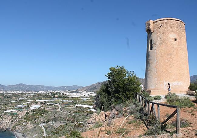
Nearby places of interest: The old Colmenarejos quarry, caves and natural rock shelters by the stream, the stone arch over the Colmenarejos stream, Nerja Cave, the village of Maro, the Águila aqueduct, Maro Tower and the Maro Cliffs nature reserve.
-
How to get to the starting point
There are two options for starting this route. The first is to set off from the village of Maro itself, leaving your car in the car park near the Hotel Playa Maro. From there, you would need to walk approximately one kilometre further along the old N-340 road, a stretch that offers no particular scenic interest. The second option, which shortens the route, involves continuing eastwards from Maro along the N-340 and turning off onto the track leading to the Molino de Casanova, where you can find parking in the surrounding area. However, you should always look for a parking space south of the A-7 motorway. Once past this old mill, there are a few paths and spaces where you can park your car. From there, head towards the bridge crossing the A-7, situated near the mill, which will serve as your reference point for the start of the route.
-
Route description
1. From the starting point, you will need to cross the bridge over the A-7 motorway, heading north. Once on the other side, continue along a dirt track heading in the same direction; in the first few metres, you will pass horses, stables and other facilities on your left. Shortly afterwards, some subtropical crop plantations begin to appear on the right. This first section, approximately 700 metres long, is relatively easy to walk along - it follows a concrete and dirt track - and leads to the area around the Colmenarejos stream.
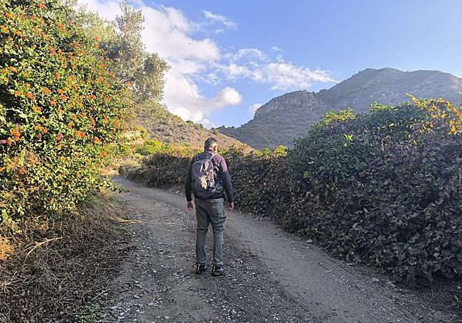
2. The path continues northwards, whilst on the right, at a lower elevation, you can make out the usually dry bed of the Colmenarejos stream. Continuing along the track, you reach the entrance to an old quarry, where there are signs prohibiting access. For decades, this site was home to numerous abandoned vehicles and machines that had been vandalised; their removal began in 2025. You must not cross through the quarry, even though it may seem like a shortcut, as it is private property with restricted access and a risk of rockfalls. Just before the signs, look out for a narrow path branching off to the left, marked with an arrow and other green markings painted on the rocks. The route continues along this path, beginning a gentle climb.
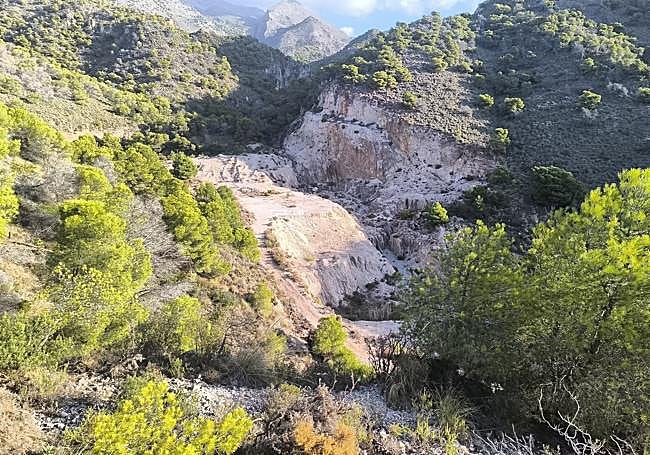
3. The path begins with a gentle climb, although it soon levels out until it becomes practically flat. From this section, you can enjoy a sweeping view of the old quarry, which lies to the right, whilst in the distance the cliffs and other rock formations that characterise this landscape begin to stand out. Over a distance of around 600 or 700 metres, the path alternates between short climbs and easier sections, offering some of the route’s most attractive scenery. The contrast between the abandoned quarry, the rocky faces and the increasingly abundant Mediterranean vegetation makes this section one of the most interesting on the route. Finally, the path descends until it joins the bed of the Colmenarejos stream. Here, once again, the green painted markings help you find your way.
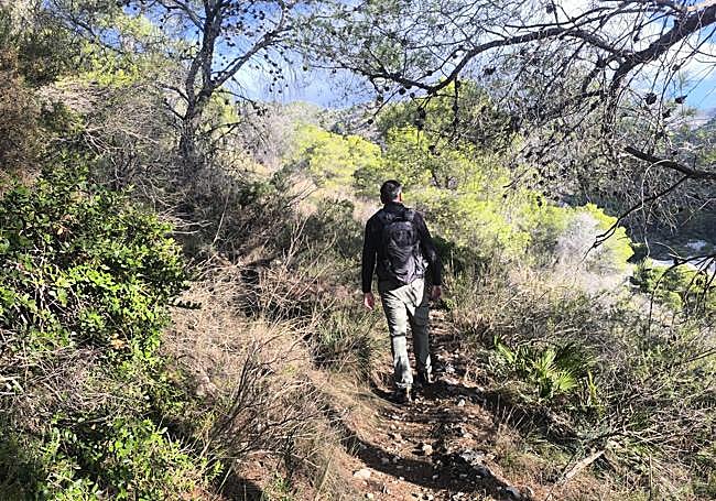
4. From here on, the route follows the stony and usually dry bed of the Colmenarejos stream all the way, so there is virtually no chance of getting lost. Just as you reach this point, you leave behind a cave that is difficult to access and, a little further on, you can make out another one popularly known as the ‘Cueva de las Tres Puertas’ (Cave of the Three Doors), situated at some height and also difficult to reach. As you continue, the landscape becomes increasingly spectacular thanks to the vertical cliffs, rocky walls and numerous natural shelters that appear on both sides of the ravine. Some of these may have served as shelters at various times, although their use is not documented. The path continues to follow the meandering course of the stream itself, in one of the most unique sections of this route.
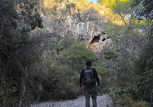
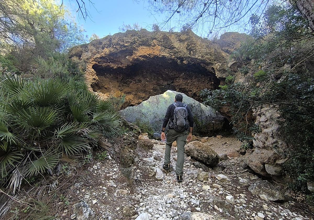
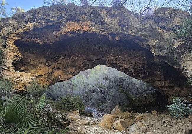
5. The walk along the stream bed is approximately one kilometre long. After walking about 900 metres along this stretch, look out to the right, where you will see the spectacular Colmenarejos stone arch, one of the most striking natural formations in this part of the Sierra Almijara. It is a large, naturally hollowed-out rock formation, the opening of which is the result of erosion processes that have taken place over a long period of time. Its size and unique silhouette, framed by the ravine’s walls, make this spot the main highlight of the walk. Although the proposed route ends here, it is possible to continue upstream along the riverbed and, via unmarked and more challenging trails, link up with the area around the Pico del Cielo footpath. Another alternative is to head east, passing through the arch itself, to extend the route across more challenging terrain, with the possibility of even reaching the valley of the Río de la Miel. Neither of these extensions forms part of the described itinerary, so it is recommended that you return along the same path to the starting point.
Flora and fauna
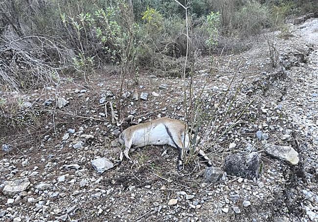
Along this route, you can see typical Mediterranean vegetation, featuring species such as Aleppo pine, esparto grass, rosemary, thyme, mastic, wild olive and juniper. As the path winds its way into the valley of the Colmenarejos stream, the natural vegetation becomes more prominent, particularly on the slopes and at the foot of the cliffs. As for the fauna, one of the most iconic animals in this area is the mountain goat, which can be spotted in the highest and most rugged parts of the ravine, so it is worth keeping an eye on the rocky faces flanking the route. Other mammals also inhabit these mountains, such as the fox, the wild boar and the genet, as well as birds of prey such as the Bonelli’s eagle and the peregrine falcon, which find suitable places in the area to take refuge and even nest.