Weather
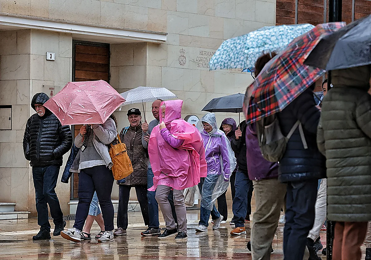
Malaga under province-wide warning for heavy rain from midnight
State meteorological agency Aemet forecasts more than 15mm in one hour, mostly between midnight and 9am on Wednesday
Ignacio Lillo
Malaga
State meteorological agency Aemet has confirmed the possibility of heavy rain in Malaga province this week. The whole province will be under a weather warning (initially yellow or low-risk) due to the possibility of accumulations of up to 15mm in one hour.
The warning covers the entire province, without exception. This past winter, the warnings were generally localised to one or more meteorological areas, which strikingly differs from the current situation. Torrential rains will also be widespread this week.
According to the forecast, the heaviest rainfall will take place in the early hours of Wednesday, 8 April, specifcially from midnight to 9am. Most people will feel the greatest impact of the rain during the morning rush hours (from 7am to 9am). Aemet forecasts continuous rain throughout the rest of the day, but with less intensity.
This new wet episode is due to the arrival of an isolated cold low, which is similar to a 'dana' in its behaviour but different in characteristics.
The storm has been moving down the Atlantic towards the south-west of mainland Spain since Monday. "It's going to be with us practically all week," director of the Aemet centre Jesús Riesco says. It will cross from west to east along the south coast and bring "unstable weather" for almost the entire week.
Wednesday will see the start of a temperature rollercoaster, with a significant drop both in the interior of the province and along the coast. On the coast, maximum temperatures will be at least 4C lower, although minimum temperatures will not fall as much (thanks to cloudy skies). Meanwhile, the drop in the interior will be more pronounced, around 7C. Therefore, temperatures in Malaga city will not exceed 18C and will fall to 15C in the Antequera district, which is "below the normal values for this time of year".
Temperatures will rise again on Thursday, as the low-pressure system's position will bring southerly air into the atmosphere at mid and lower levels. "We'll see temperatures climb back up to 24C in Malaga city and 25C in Antequera," Riesco says. Furthermore, little to no rain is expected that day, although the meteorologist cautions that a slight change could alter the forecast.
Weather expert José Luis Escudero agrees that there is a chance of light rain on Tuesday afternoon in the westernmost part of the province. However, more precipitation is expected on Wednesday. "Both the European and American models agree and it is very likely that some areas will be under a rain warning on Wednesday."
According to forecasting algorithms, rainfall of 30 to 40mm could accumulate in 24 hours, particularly in the Antequera district, the Guadalhorce Valley and the Axarquía district. Malaga city, half of the Costa del Sol up to Fuengirola and the wider Malaga area will also receive significant rainfall.
What will the weather be like during the weekend?
Heading into the weekend, there will be some more rain, initially light, as the same low-pressure system crosses the southern part of Spain and moves eastward. "At that point, it will weaken, but it may still bring some rain," experts warn.
Between Friday and Sunday, a gentle warm wind will prevail, which will maintain temperatures around 20-21C in Malaga city on Saturday. At the same time, temperatures in the Antequera district will drop again to around 16C (almost 6C less than on Friday) due to that cold entry from the north.
On Sunday, temperatures will continue to drop, reaching around 17C in Malaga and 13C in Antequera. "There will be ups and downs throughout the week, with generally unsettled weather," Riesco says.
To make matters worse, from Wednesday onwards, and especially on Thursday, there may be haze due to the low-pressure system. The combination of suspended dust and precipitation could lead to generally light mud rain.
José Luis Escudero says that this phenomenon will be most noticeable late Wednesday night and throughout Thursday, although the concentration of suspended dust should decrease on Friday. "Don't worry, it won't be like in March 2022," Escudero says.
Click here for today's weather