Environment
Malaga is experiencing a marine heatwave, with water temperatures up to five degrees above average
Concern within the scientific community extends beyond the impact on ecosystems and the introduction of tropical species: autumn storms could be very severe
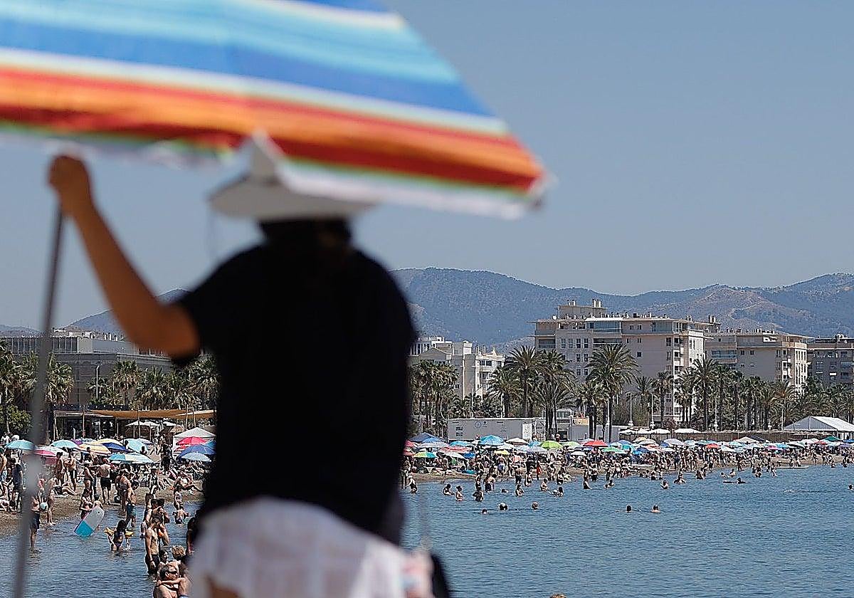

Malaga is experiencing a marine heatwave, with average water temperatures up to five degrees higher than the norm. Many bathers will welcome what may seem ... like a wonderful water temperature, but the indicators are causing great concern amongst the scientific community.
These figures have been verified by up to three different measurement systems, which vary slightly from one another but confirm an upward trend that is disrupting ecosystems. This is predicted to lead to increasingly severe storms and downpours in the autumn due to high levels of evaporation.
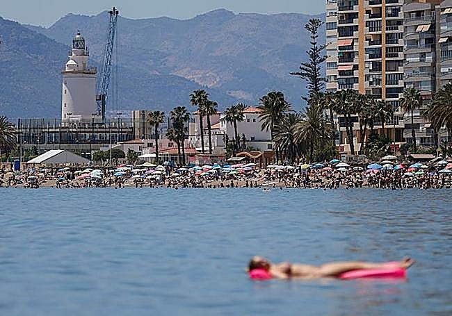
25.7ºC
The buoy off Malaga has reached an average temperature of 25.7ºC
These figures are for the last three weeks of June and are almost 5°C above the historical average
Manuel Vargas, a physicist at the Malaga oceanographic centre of the IEO-CSIC, said that this global and local warming is facilitating the arrival of tropical species and significantly increasing the risk of torrential rain in autumn. He explained that the western Mediterranean - and, most notably, the Costa del Sol - is experiencing temperatures that are extremely unusual for this time of year, resulting in an intense marine heatwave that has been building up throughout the month of June.
Related story
-
 Isabel Miranda
According to data from the Puertos del Estado buoy located off the coast of Guadalmar in Malaga, the water temperature reached 25.7 degrees Celsius at the start of July, an alarming figure when compared with historical climate data.
“At this time of year, we should be around 20 degrees. In other words, according to our records, we are more than five degrees above the average,” Vargas said.
8ºC
The temperature in the Gulf of León has soared by several degrees above average.
This is an extreme heatwave within the context of a wider phenomenon across the western Mediterranean
Although measurements taken by the European Copernicus service’s satellites slightly downplay the anomaly in Malaga to just over three degrees above normal, the scientist insisted that the situation across the western Mediterranean is extreme. In areas such as the Gulf of Lion, the water temperature is eight degrees above normal, a figure the physicist described as "absolutely outrageous". That area lies off the coast of the regions of Occitanie and Provence-Alpes-Côte d’Azur in the south of France.
“The sea is much calmer, the wind is less strong, and that means there are fewer waves, which in turn means that the heat is absorbed by the uppermost layers”
Technically, a marine heatwave is defined using the same statistical criteria as land-based heatwaves, based on 30-year records: "We are seeing values which, if we look at the historical record, have occurred on no more than one per cent of days in late June. In other words, it is highly unlikely and very rare. For this warming to be classified as a marine heatwave, the anomaly must last for at least five days. On the Malaga coast, it has been going on for almost a month: we are experiencing a very long and very intense marine heatwave,” he explained.
The causes behind this rise in temperature stem from what Vargas calls "the perfect cocktail". On the one hand, there are the persistent atmospheric heatwaves that have drawn in masses of very warm air from Africa. This has caused the sea to absorb an enormous amount of energy.
On the other hand, the remarkable stability of the sea has played a crucial role. “The sea is much more stable; there is less wind, which means there is less swell - in other words, it is churning less - and this means that the heat is absorbed by the uppermost layers,” Vargas said.
In conditions of heavy swell, common in autumn and winter, the surface heat would mix with the lower layers, lowering the overall surface temperature - something that is not happening at present.
“This build-up of heat in the sea poses a significant risk factor for the development of atmospheric disturbances in the coming months”
The current worrying picture stands in stark contrast to the weather conditions at the beginning of June, when Malaga enjoyed a brief respite from the rough seas.
Around 5 June, underwater thermometers recorded normal readings of 18.5 degrees due to the arrival of westerly winds, which turned into onshore winds (north-westerly).
“This lowers temperatures significantly due to a phenomenon known as upwelling. The wind pushes the water from the coast out to the open sea, and that water is replaced by water from deeper down. The water deeper down is always colder because it doesn’t receive the sun’s energy,” explained Vargas.
However, that respite lasted barely two or three days, and the water quickly warmed up again. The physicist said that the behaviour of the waters off Malaga is currently in line with that of the rest of the Mediterranean and is fully in line with the global temperature anomaly.
"Weather fuel"
The excess heat stored in the sea will act as a dangerous "weather fuel" over the coming months. Although storm fronts are a normal feature of the Mediterranean climate as the summer draws to a close, the current situation suggests a substantial change in their behaviour. Vargas said that as summer draws to a close and autumn begins, these storms are set to become increasingly destructive, more intense and also more frequent.
Sea level
Furthermore, looking to the medium and long term, the scientist points out that this persistent warming will inevitably accelerate sea-level rise.
In the same vein, the weather presenter and author of the blog ‘ Tormentas y Rayos’ on SUR, José Luis Escudero, said that the data provided by the European Copernicus programme reflects a clear thermal anomaly in the waters surrounding the Iberian Peninsula.
"The Mediterranean, the Atlantic off Portugal and the Cantabrian Sea are well above average. This build-up of heat in the sea poses a significant risk factor for the development of atmospheric disturbances in the coming months."
The expert is unequivocal in directly linking this warming to the possibility of severe weather events. “It is very worrying that the sea remains so warm,” he added, recalling the dramatic events in Valencia in 2024.