Andalusian escape
Serrato-Almorchón de Gutiérrez: The circular route that leads to the heart of the Guadalteba
This trail, which has been approved since 2023, reaches the highest part of this village in Malaga, from where there is a wide panoramic view

Malaga
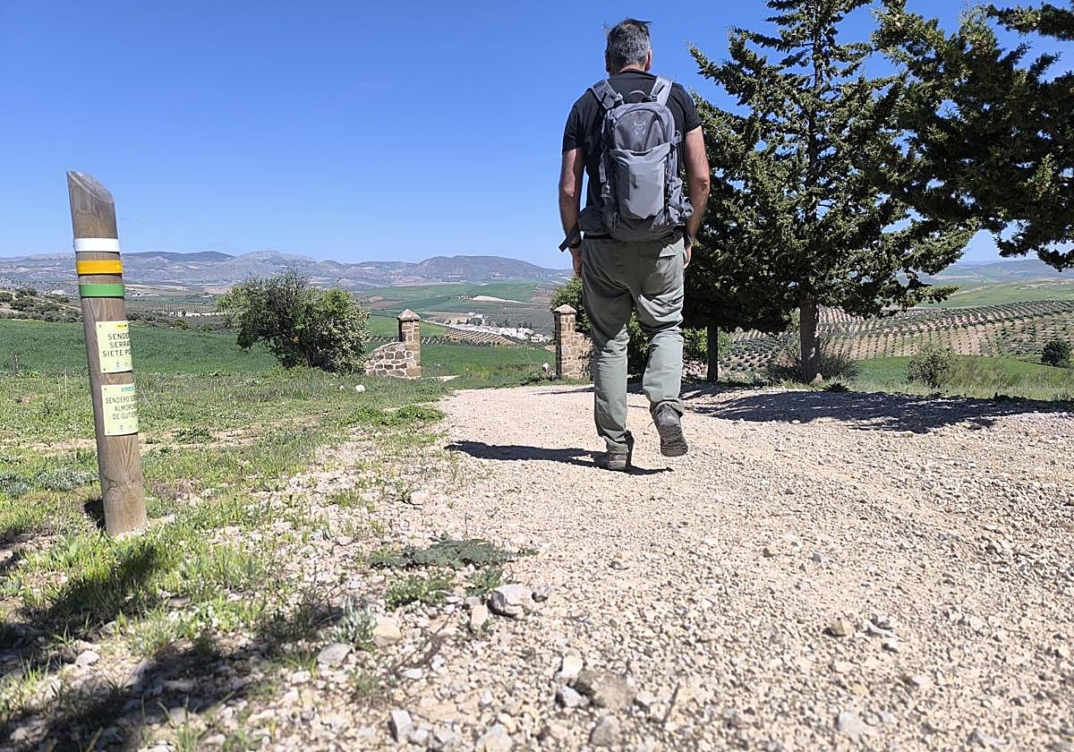
Signposted footpath SL-A 350 that starts in the village of Serrato and climbs up to the base of Almorchón de Gutiérrez, in its south- ... eastern sector.
-
Route data
Comarca: Guadalteba
Municipality: Serrato
Difficulty level: Medium. A route without technical complications, but with an accumulated difference in altitude. It is signposted to the base of the hill known as Almorchón de Gutiérrez.
Type of route: Circular
Approximate duration: Three hours and 45 minutes
Length: 11.9 kilometres.
Minimum height: 499 metres
Maximum altitude: 957 metres
Nearby places of interest: Cortijo de los Balazos, Cerro de las Peleas, Almorchón de Gutiérrez, Nuestra Señora del Rosario church, Fuente del Caño and Los Remedios hermitage.
-
How to get to the starting point
To begin this route, head towards the village of Serrato , which can be reached via the MA-477 road. This in turn must be taken from the A-367, which links Campillos with Ronda. Once in the village, head towards the Fuente del Caño . Next to it, you will see the sign that marks the starting point of this route. You can park near this spot or in some of the streets in the centre of Serrato.
-
Route description
1. From the signpost at the beginning of the route, head south in the opposite direction to the village. The first few metres of the wide path run through some wheat fields. Only one kilometre from the starting point you reach a fork in the road. Both paths actually lead to Almorchón de Gutiérrez, as from there it is a circular path. However, it is advisable to take the one on the left on the way out.
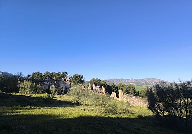
2. After fording the bed of the Ventanas stream, you will have to be very careful to follow the signs on this certified path, as you will have to start walking between the boundaries of two agricultural estates. You will have to walk approximately one kilometre and about three hundred metres along this path until you come to the next confirmation marker. Then take a wide dirt track that leads into a pine forest. As soon as you enter the pine forest, you will see a signpost indicating the path to follow, although it is recommended to approach the Cortijo de los Balazos, which is also signposted, although it is not officially part of this trail. In this case, you will have to walk back and forth to this ruined building, which is less than two hundred metres from the signpost.
3. Once you have seen the farmhouse and returned to the official path, you will have to continue along the aforementioned pine forest, bordering it, with several ascents and descents, until you face a considerable ascent. You will have to walk a little over two kilometres on this route until you reach a crossroads. At this crossroads, the path that leads to the Almorchón de Gutiérrez is indicated on the left, which is clearly visible both from here and much further on. To do this, you will have to walk along a firebreak and tackle another demanding climb until you reach the foot of this geological formation.
4. The path is only signposted up to the base of the Almorchón de Gutiérrez, located next to the Peleas hill. It is not advisable to climb it if you do not have experience in this type of ascent among limestone rocks. Both from the top and from the foot of the rock formation there are impressive views of the Guadalteba Valley. If you climb up or simply go around the Almorchón de Gutiérrez, the views to the south, where the territory of the Sierra de las Nieves is located, would also be greatly enhanced.
5. From the base of Almorchón de Guitiérrez we will have to go down the same firebreak we arrived on, until the crossroads mentioned above. From there it is time to return to Serrato along a different path, except for the last few metres. After a gradual descent with some shade thanks to the pine forest, you will reach the Cortijo del Madroño. This means that after a little over a kilometre of walking you will join this historic building with another of Serrato's certified footpaths, the Siete Pozos (PR-A-489). From there it is just over two kilometres to the Fuente del Caño. Before this, you will pass next to the fork where you took the path on the left.
Flora and fauna
Although the route starts out among olive groves and cereal fields, it soon enters a much more varied landscape, with an interesting forest of repopulated pines. Along the route there is also typical scrubland, with species of botanical interest with aromatic plants - such as rosemary - or even more unusual ones such as the morra, a wild artichoke that for years formed part of the traditional diet in the area.
As for the fauna, this itinerary offers plenty of attractions. In the open areas it is not unusual to see partridges, rabbits or hares, while in the rocky cliffs and reliefs rocky birds can be seen. In addition, the sky is frequently punctuated by the presence of birds of prey, reinforcing the value of Serrato as an enclave of ornithological interest. It is no coincidence that species ranging from owlets or solitary rock thrushes to black starlings have been observed in this area, and even, sporadically, the odd imperial eagle.