
Climate change
The areas of Andalucía that could be flooded by 2100 due to global warming
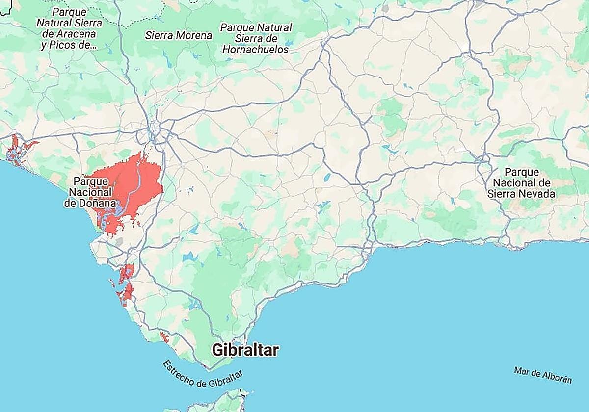
The Climate Central tool features an interactive map predicting which coastal zones will be worst affected
D. C.
Experts are warning that the effects of climate change could have an impact on our towns and cities sooner than you may think.
In the ... medium term, rising sea levels could threaten low-lying coastal areas with severe flooding. In less than 75 years - by the year 2100 - a large part of western Andalucía could be submerged by the sea.
This is according to Climate Central, a coastal risk screening tool that provides an interactive map projecting annual flood levels for the year 2100.
According to the simulator, a significant portion of the city of Cádiz, as well as the town of El Puerto de Santa María, would be flooded by rising sea levels by the turn of the next century.
However, one of the hardest hits would be taken by the Doñana National Park, which would be left almost entirely underwater.
The simulator also shows rising sea levels reaching as far inland as the outskirts of Seville, with the water level rising up to the town of Coria del Río. In Huelva, Punta Umbría and parts of the provincial capital would also be affected.
In eastern Andalucía, the projected impact is less severe. Only small areas would be affected, including parts of Almuñécar and Torrenueva in Granada, Almerimar in Almería, and Torre del Mar in Malaga.
![[]](http://static.vocstatic.com/voc26/latest/assets/images/favicon/surinenglish/apple-touch-icon-57x57.png)