Andalusian escape
Climbing the Alcuza peak (from Puerto de la Torre): a rewarding ascent
This route climbs up to a summit that, despite not exceeding 600 metres in altitude, offers an exceptional panoramic view of the coast and the interior of the province

Málaga
This route starts in the district of Puerto de la Torre in Malaga and climbs up via old rural roads, wine presses and surrounding hills until it reaches the Alcuza peak, an elevation located in the Sierra de los Verdiales, in the northern sector of the municipality of Malaga.
-
Route data
Province: Malaga
Municipality: Malaga
Difficulty level: Medium. It is necessary to take into account not only the accumulated difference in altitude, but also the orientation, as the route is not officially approved or signposted. At several points it is necessary to find your way around using landmarks such as old wine presses, farmhouses or hills, so it is advisable to carry a GPS application or a downloaded track.
Type of route: Linear
Approximate duration: 2 hours (one way)
Length: 4.5 kilometres (one way).
Minimum height: 193 metres
Maximum altitude: 543 metres
Nearby places of interest: Lagar de la Carihuela, Casa de la Tormenta (Cortijo San Antonio), Cerro del Corcel, Limonero reservoir, tower and hermitage of Los Verdiales, Montes de Málaga natural park, Ciudad de Málaga forest park, viewpoints of Mendelín, the Amigos del Jardín Botánico and Los Camineros Forestry Group, source of the Los Ángeles stream and old water mines.
-
How to get to the starting point
The starting point of this route is in the district of Puerto de la Torre in Malaga. To begin the route, head for Calle Fuente Alegre, in the district of Arroyo España, which ascends towards the upper part of the district. The most practical place to leave your car is at the junction of Calle Fuente Alegre and Calle Neptuno. Just before reaching the latter, on the left hand side as you go up Fuente Alegre, there is a small dirt esplanade where you can park your car in relative comfort. From this point, cross the road to take a dirt track that gradually leads away from the town centre and marks the beginning of the route.
-
Route description
1The first few metres of the route gradually leave the urban environment of Puerto de la Torre. For approximately 700 metres the route follows a dirt track that alternates a short climb with a gentler section that leads to a subway under the dual carriageway. This point marks the transition between the urban landscape and the hills surrounding the city. In this first section the path runs alongside a small stream that accompanies the walker for part of the route.

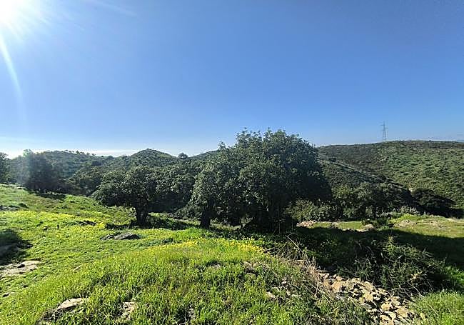
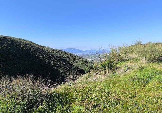
2The landscape then becomes more natural. The track continues with a gentle slope in a northerly direction while the stream remains to the right of the path. After approximately two kilometres, there is an important turn to the right that separates the route from the stream. Along this stretch you will see palm trees, holm oaks and some large eucalyptus trees, as well as riverside vegetation. Small dams and some scattered rural dwellings can also be seen, evidence of the former agricultural use of these hills.
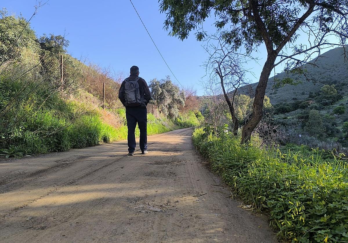
3From here the route crosses an area of land and houses, where there are concrete sections that facilitate access to the properties. The path climbs gradually and offers a little-known view of the north of the city of Malaga. After about 800 metres from the previous point, leave the main track to take a path that heads off to the right and continues to gain height towards the hills that lead to the upper part of the route.
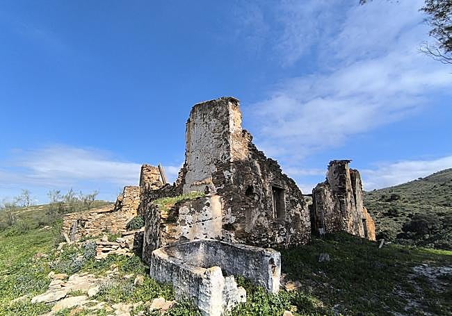
4The next sector requires attention to orientation. The path leads to the ruins of the Carihuela wine press, an old agricultural complex whose walls are still partially preserved. From here, the nearby cortijo or house of La Tormenta (or San Antoni) is used as a reference point, although it is not necessary to take a detour to it. There are several tracks and paths in the vicinity, so it is advisable to pay close attention. The correct route is a narrow path that ascends next to a carob tree, which is at the foot of the Cerro del Corcel.
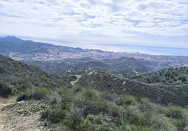
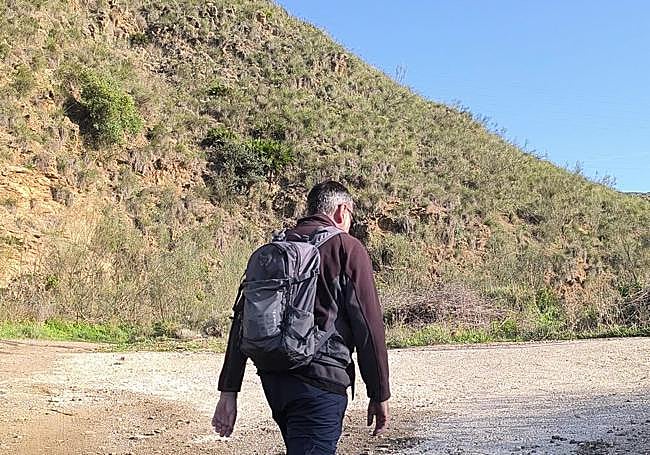
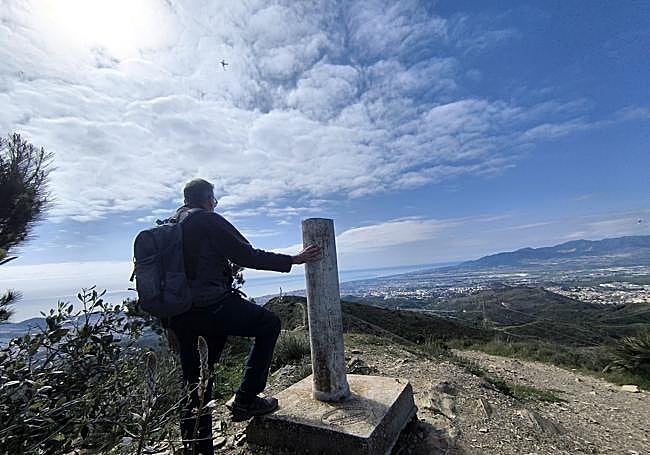
5From this point the path continues along the Cerro del Corcel, practically following its crest. This section offers a very broad panoramic view of the city of Malaga, from the area of La Araña and its cement factory to Puerto de la Torre, with the Mediterranean on the horizon. After reaching this hill, turn northwards, where you can clearly see the Alcuza peak and its geodesic vertex, whose official altitude is 542.95 metres above sea level, according to data from the National Geographic Institute. The last stretch requires overcoming small undulations in the terrain before tackling a final ascent of some 40 metres in height. From the summit you can enjoy a 360-degree panoramic view of the city of Malaga, the Limonero reservoir, the Montes de Málaga, the Torcal de Antequera, the Abdalajís valley and nearby towns such as Villanueva de la Concepción. The name Alcuza comes from the Hispanic Arabic alkúza, a term that refers to a vessel traditionally used to contain oil. Some toponymic studies suggest that the name may refer to the shape of the hill or to the ancient presence of olive groves in the area. In addition, archaeological remains associated with Bronze Age settlements have been documented in the vicinity of the peak, confirming the long human occupation of these hills located between the coast of Malaga and the interior of the province.
Flora and fauna
The route crosses a landscape typical of the periurban hills of Malaga, dominated by Mediterranean scrubland, palm and holm oak trees, together with some eucalyptus trees in the wetter sections of the route. In the areas close to the stream there is riverside vegetation, while in the higher parts there is a predominance of species typical of the coastal mountains of Malaga, such as carob, wild olive and almond trees. It is not uncommon to see birds of prey such as the kestrel flying over these hills. Large mammals such as the mountain goat have also been sighted in the area. It should be borne in mind that these hills are in the area of the Montes de Málaga natural park.