Weather
Andalucía under yellow alert for storms and hail on Tuesday
The Aemet state meteorological agency will activate the warning at 4pm
Almudena Nogués
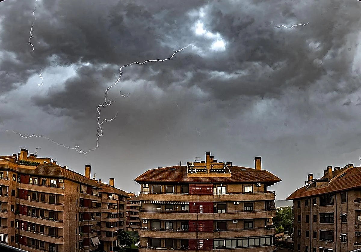
Andalucía will not escape the hailstorms Aemet (Spain's meteorological agency) has forecast in Spain this week.
The agency will activate two weather warnings concerning the region from 4pm on Tuesday.
It forecasts "occasional storms in the mountains, accompanied by showers and occasionally very strong gusts of wind". On its official social media account, Aemet notes that the presence of cold air aloft will be responsible for this instability, which could bring some sudden, "locally intense" rain to certain areas in the eastern part of Andalucía.
Related story

The Aemet alert concerns the areas of Cazorla-Segura, the Guadalquivir Valley, Seville, the mountains in the province of Jaén, the Guadix-Baza and the Genil basin, in Granada, which can expect very strong winds and hail.
On Tuesday, Andalucía will have "generally clear skies, with increasing cloudiness in the mountains, accompanied by occasional showers and thunderstorms".
According to the Aemet forecast, temperatures will rise across the board, except along the Mediterranean coast. The highest temperatures will be in Cordoba and Seville, reaching 37C and 36C, respectively.
Minimum temperatures will also be high, reaching 22C in Malaga province. Additionally, a moderate easterly wind will blow along the Mediterranean coast.
Delegate of Aemet in Andalucía Juan de Dios del Pino said that temperatures would gradually rise by about 5C until Saturday, "going from current 35C to 40C at the weekend". According to him, this "could be the first heatwave of the season".
Aemet has already activated extreme heat warnings, starting at 1pm on Wednesday in the Guadalquivir Valley, concerning Seville, Cordoba and Jaén.
Possible first heatwave of the season
Del Pino hasn't ruled out the possibility of Aemet activating amber weather alerts this weekend, if a heatwave starts.
Aemet has stated that there will be little wind, light and variable, with a sea breeze along the coasts. Del Pino said that this weather pattern is characterised by high pressure over mainland Spain, with a cold air mass in the upper troposphere, which will generate instability.
The temperature contrast between the cold air above and the warm air below will lead to some instability, especially in the afternoons when the sun is strongest, causing the formation of clouds that could lead to storms.
Today's weather forecast for Malaga province